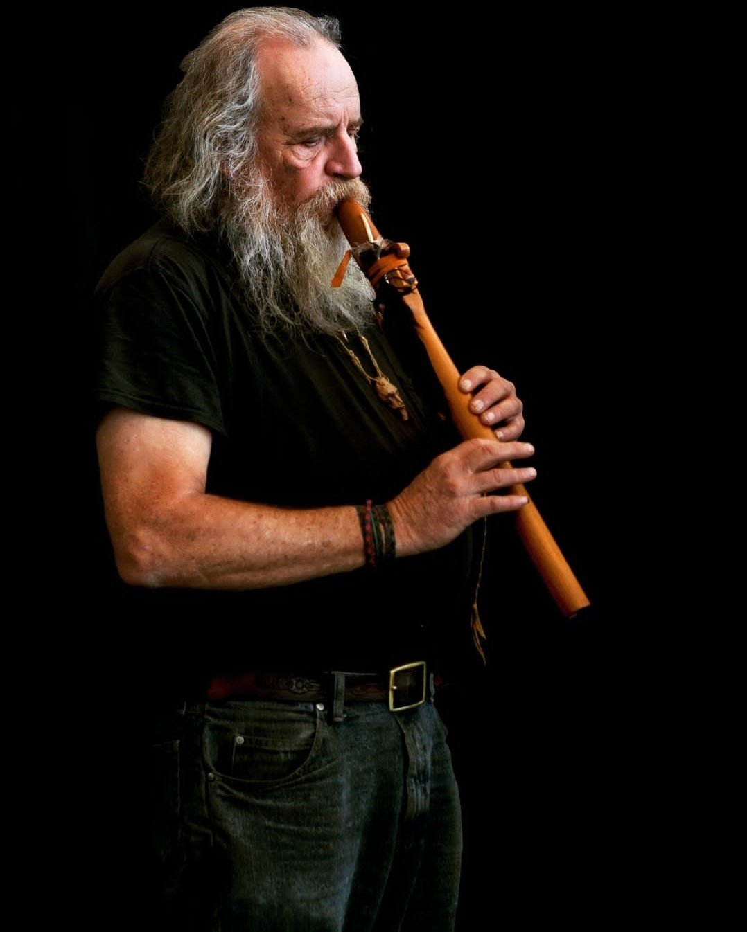
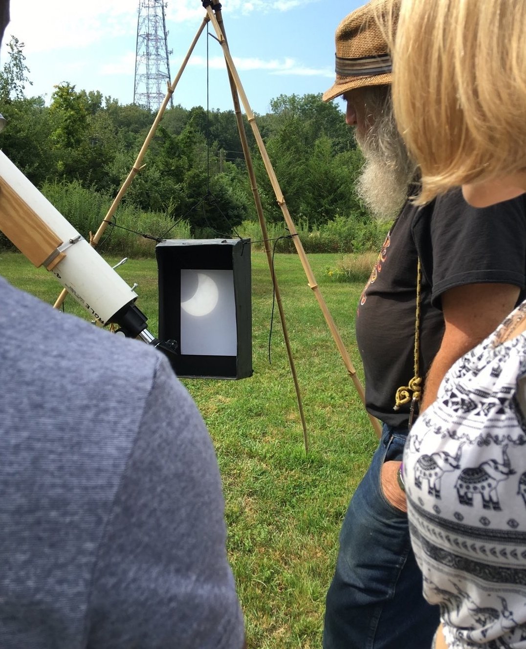
We mourn the loss of our treasured friend Bob “Bobcat” Carruthers: teacher, bioregionalist, busker, flutist, guitarist, bluesman, mentor, tinkerer, astronomer, popcorn maker, moonshine mixer, philosopher, guru of simple living, good-naturedness and goodwill. A master teacher and practitioner of bioregionalism, Bobcat and his free spirit and life-affirming sense of humor will never be forgotten. He is now a star in the night skies he loved so much. Thank you, friend.
Posted inNews|Comments Off on In Memoriam: Bob “Bobcat” Carruthers, 1947-2022
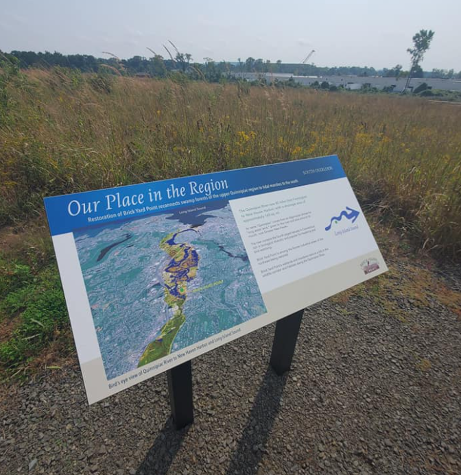
We had a great time this morning visiting the new nature preserve at Brickyard Point in North Haven, which was formerly a highly polluted brownfield site (the Upjohn Chemical plant) that has now been reclaimed as a wetlands preserve and nature center! There are excellent trails, numerous interpretive signs, osprey nesting platforms, and beautiful views from two scenic overlooks. Currently you have to make a reservation to visit but we will be organizing a group trip there next spring – stay tuned!
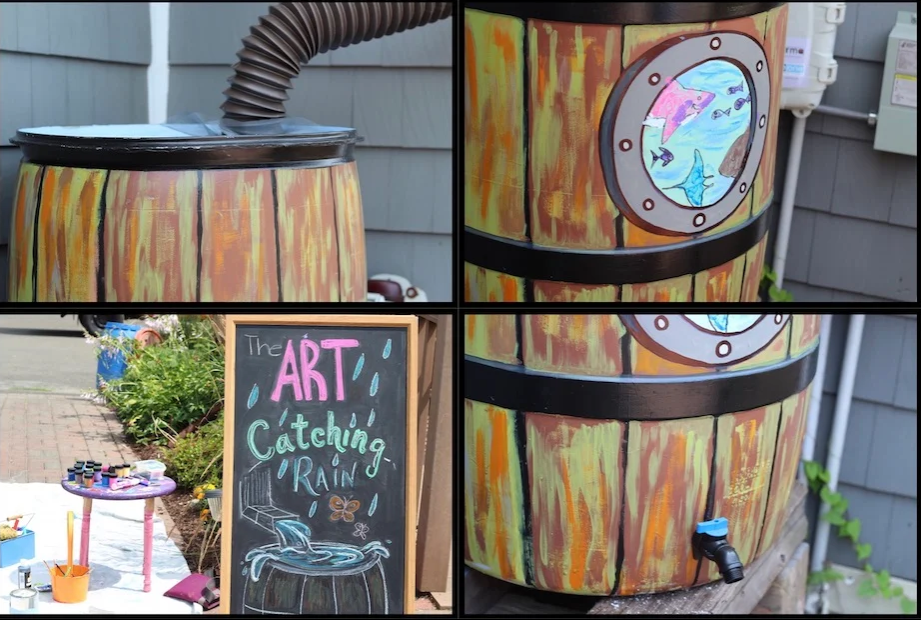
We have new barrels available and the final rain barrel workshop of the season will take place on Saturday, Sept. 18 at noon. This is for greater New Haven residents (New Haven, Hamden, East Haven, and Woodbridge), courtesy of the GNH Water Pollution Control Authority (WPCA) and the Bioregional Group. WPCA provides the barrels and the connection kit with spigot (may need one or two additional pieces of hardware, depending on how you want your set-up), and we will provide the installation training. Save money watering your plants with rainwater, prevent pollution by stopping the sewer lines from backing up when there are downpours. Please contact us if you are interested in attending the workshop and getting your barrel.
Posted inNews|Comments Off on Rain Barrel Update – August 2021
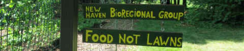
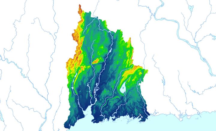
The New Haven Bioregional Group began in 2005 as a collaborative effort to “walk the watersheds” of the Quinnipiac Bioregion. Our intellectual and spiritual guide, Peter Berg, built the edifice of bioregionalist philosophy on the foundation of watershed-based thinking and governance. In our 15+ years of existence, we have been early and enthusiastic supporters of watershed coalitions for the West River and the Mill River, which have grown into thriving organizations that catalyze relationships across socioeconomic, racial, age, and geographic boundaries.
In “A River Speaks,” New Haven documentary filmmaker Steve Hamm has created a beautiful, deeply bioregional film that weaves together the human and natural history of one of the principal watersheds of our bioregion. It manages to be both a lyrical visual essay and a compelling, fact-filled narrative that is chock full of science, history, sociology, and philosophy. We hope you can join us for a screening and discussion with Steve for Earth Day this Saturday, April 24!
We have received a number of requests lately regarding rain barrels. Over the last four years, we have given out over 150 *FREE* rain barrels across New Haven and given dozens of demonstrations about installation of rain barrels and best practices for controlling stormwater pollution. We are very proud of this work.
Unfortunately, we are currently out of rain barrels and are unsure when we will be getting a new supply. If you contact us and let us know of your interest, we will make sure you are among the first to be notified when we are able to offer free rain barrels again to the community. Also, please let us know if you would like to host a rainbarrel party at your home, where you invite your friends and neighbors to learn about stormwater, and we bring the free barrels!
[Photo: Lucy Gellman.]
Posted inNews|Comments Off on Rain Barrel Update – Aug. 2020
Controlling our stormwater runoff has been one of our top priorities over the last few years. Did you know that stormwater is the #1 source of pollution in most Connecticut waterways, and that millions of gallons of raw sewage flow into New Haven’s rivers and harbor every year because of stormwater-related combined sewer overflows?
We are pleased to share this “Bringing in the Rain” stormwater management educational video, produced in conjunction with Save the Sound and funded by the Greater New Haven Green Fund:
Our sincere thanks to:
Anna Marshall, Save the Sound
Ron Walters, Regional Water Authority
Adam Rawlings, Neighborhood Housing Services of New Haven
Doreen Abubakar, Community Placemaking and Engagement Network (CPEN)
Dr. Gaboury Benoit, Yale School of Forestry and Environmental Studies
Gary Zrelak, Greater New Haven Water Pollution Control Authority
Kel Youngs, Barnard Environmental Studies Magnet School
Greater New Haven Green Fund
___________________________________________
Enjoy and please share!
Posted inNews|Comments Off on ‘Bringing In The Rain’ Stormwater Education Video
We are very grateful to local eco-ally Elaine Piraino-Holevoet for compiling this informative “Downsizing Donation Guide” — a tremendous resource for anyone in the New Haven area looking to give away items to worthy nonprofits!
Posted inNews|Comments Off on Downsizing Donation Guide
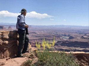
Bioregional Group member Steve King (pictured below in Utah) has compiled a Comprehensive Guide to Reducing, Reusing, and Recycling in the New Haven area. We are very grateful to Steve for developing this tremendous resource. Read this NY Times story about why recycling is positive and beneficial but only one part of a comprehensive strategy to reduce waste and protect the environment! Remember to practice all three R’s: REDUCE, REUSE, AND RECYCLE!
[Author Steve King in Utah]
Posted inNews|Comments Off on NEW!!! ‘Zero Waste’ Guide for New Haven Area
An exciting project to connect different parts of the Mill River watershed with a pedestrian linkage got a major boost recently when the State of Connecticut approved a $289,000 grant for developing two sections of the proposed Trail.
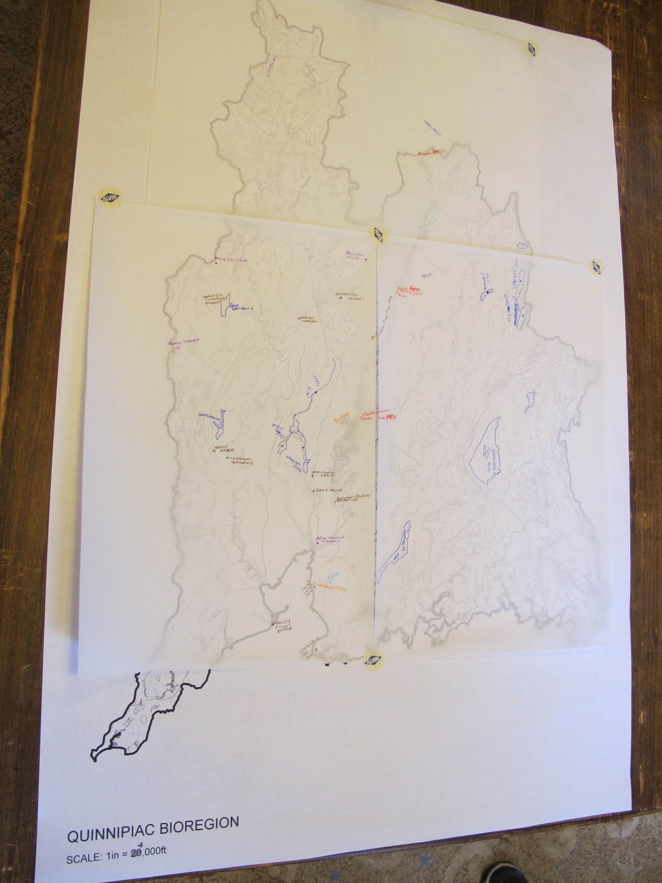
What does it mean to be a bioregionalist? On March 19th, 2016, members of the Bioregional Group and other environmental, civic, and political organizations gathered at the First Unitarian Universalist Society at 608 Whitney Avenue, to consider that question through the lens of geography and mapping, which as Fred Cervin would say is one of the essential forms of “bioregional practice.”
Some of the definitions of bioregionalism that emerged: “Knowing our place…desire and necessity to work towards a “sustainable” way of life…rediscovering Earth as it is – interacting with complex, intelligent systems, being in relationship…creating cycles…becoming acquainted with what’s happening…building resilience.”
Specifically how do these definitions relate to the New Haven / Quinnipiac Bioregion?
Ideas that bubbled to the surface captured the beauty and the vulnerabilities of our place: “Watersheds for the three rivers of our harbor…foodsheds…destruction of wetlands and rich coastal habitat…comprehensive solid waste strategy…local businesses and local food…ecology, economics, culture of place…”
Two 24×36″ black-and-white maps were laid out on the table — one of the streets and waterways of the City of New Haven, and the other of the watersheds and topography of the New Haven-Quinnipiac Bioregion. With these maps serving as the base layers, we overlaid them with tracing paper and began to add layers of our own experience. Bike commutes were drawn in favorite colored pens. Combined Sewage Overflow sites were plotted. Favorite hiking spots, locations of community meeting places, parks, gardens, beaches.
Other maps were referenced, and questions filled the room. We were left with ideas for places to visit, things we want to learn more about, and how others might add their own layers to these maps. We continued to consider how we might create maps that tell stories about our experience with our place. We look forward to seeing where this takes us, and we invite you to join in the exploration.
Posted inNews|Comments Off on New Bioregional Mapping Project Takes Shape
Earth Loyalty & Bioregional Practice - Get Your Copy Today
Bioregional Quotations
Here is perhaps the most delicious turn that comes out of thinking about politics from the standpoint of place: anyone of any race, language, religion, or origin is welcome, as long as they live well on the land. The great Central Valley region does not prefer English over Spanish or Japanese or Hmong. If it had any preferences at all, it might best like the languages it has heard for thousands of years, such as Maidu or Miwok, simply because it is used to them. Mythically speaking, it will welcome whomever chooses to observe the etiquette, express the gratitude, grasp the tools, and learn the songs that it takes to live there.
― Gary Snyder, “A Place in Space: Ethics, Aesthetics, and Watersheds”
Bioregional Quotations
In treading upon the insubstantial ground of the future we take certain risks, and we must face the fact that the word “utopian” has become an epithet, a chastisement, for those who would dream of things that never were and imagine that they still might be. Yet it is a necessary part of any political construct that it offer an image of the future that can be regarded as positive and liberatory and realistic and energizing. This, I submit, bioregionalism succeeds in doing.
― Kirkpatrick Sale, "Mother of All: Introduction to Bioregionalism"
Bioregional Quotations
From "Earth Loyalty" by Fred Cervin:
Unless we personify Earth, we will not be able to repent, will not change enough, or soon enough. The writing is on the wall, stark and terrible. Implacable forces are already in play. The future of our species on this planet is at stake. It’s not just at risk. Don’t say it’s at risk. Disaster is a certainty if we don’t change radically. We are on a runaway train heading toward an abyss.
All this is happening because we have forgotten our Mother the Earth. We have no regard for her. We make our most consequential economic decisions without a thought for Earth. We treat her like an inert mass of raw materials or like a sterile desert of no use except as a place to throw our garbage. What we have lost fundamentally is a fresh, lively sense of our own dependence. We think of our relations with Earth as environmentalism— as if Earth were a mere externality, something in need of minimal maintenance—rather than being bone of our bone and flesh of our flesh. “Mother Nature” is a tired, worn-out figure of speech, useful only for sentimental greeting cards. The reality is quite different. She is the Goddess, and She will be honored, whether in heartfelt love and respect, or in catastrophe. Those who despise her will pay the price.
I say there is now only one way left, one hope for our species: to love Earth. To feel in our hearts that we are a part of Her, what we do to Her we do to ourselves. If you love Earth, you will not fail to evaluate any possible action in light of its effects on the one you love. If you love Earth, then you will vow earth loyalty. This is the one way change can come in time: hundreds of millions vow Earth Loyalty. There is no other way.
Bioregional Quotations
Bioregional awareness teaches us in specific ways. It is not enough to just ‘love nature’ or to want to ‘be in harmony with Gaia.’ Our relation to the natural world takes place in a place, and it must be grounded in information and experience.
— Gary Snyder
Fred Cervin: What is Bioregionalism?
What is a bioregion?
"A bioregion is defined in terms of the unique overall pattern of natural characteristics that are found in a specific place. The main features are generally found throughout a continuous geographic terrain and include a particular climate, local aspects of seasons, landforms, watersheds, soils, and native plants and animals. People are also counted as an integral aspect of a place’s life, as can be seen in the ecologically adaptive cultures of early inhabitants, and in the activities of present day reinhabitants who attempt to harmonize in a sustainable way with the place where they live." -- Peter Berg, 2002